Tag Archive for: maritime surveillance

Seabed sensors and mapping: what China’s survey ship could be up to

Civilian exploration may be the official mission of a Chinese deep-sea research ship that sailed clockwise around Australia over the past week and is now loitering west of the continent. But maybe it’s also attending to naval duties.

These could have included laying or servicing seabed acoustic sensors and possibly detailed mapping of parts of the ocean floor to support future submarine operations.

Open-source tracking data enables such educated guesses to be made, without discounting the possibilities of economic and scientific data-gathering.

The ship, Tansuo Yi Hao (Exploration 1) took a similar route around Australia in January 2023, investigating 1100km of the Diamantina Trench over 34 days. China’s state media later said this was the first time the bottom of the trench had been reached. The ship carries a crewed submersible, the Fendouzhe (Striver), capable of long-duration forays to the seabed in depths exceeding 10,000 metres.

As in 2023, rather than proceeding directly home from New Zealand, where it was conducting joint activities with a partner institution, the ship has again undertaken a long deviation around Australia. Its transitory presence in the Bass Strait and inside Australia’s 200 nautical mile exclusive economic zone (EEZ) was nonetheless permissible under international law, as long as the ship undertook no commercial survey activity and maintained continuous passage, showing ‘due regard’ to the coastal state.

However, speculation quickly grew that Tansuo Yi Hao could be gathering intelligence on Australia’s seabed cables. When questioned by media about its presence, Prime Minister Anthony Albanese said he ‘would prefer that it wasn’t there’.

Tansuo Yi Hao subsequently stayed mostly outside of the EEZ as it traversed the Great Australian Bight. Nor did it appear to loiter before reaching the Diamantina Trench, about 1100km off the Western Australian coast and well beyond Australia’s maritime jurisdiction.

Given the inherently dual-use nature of China’s marine scientific research assets, it would be prudent to assume that Tansuo Yi Hao and the submersible are subject to some level of military tasking. They belong to China’s Institute of Acoustics, which according to its own website has ties to the armed forces, dating back decades.

Sending a survey ship around Australia is less obviously coercive than similarly deploying a naval task group, as Beijing did in February and March, and China’s survey vessels are more common near Australia than generally known. But the passage is a further demonstration of China’s growing strategic reach and interest in operating beyond the first island chain.

According to automatic information system data from Starboard Maritime IntelligenceTansuo Yi Hao has paused daily for 12 to 17 hours over the Diamantina Trench since 6 April. This is consistent with the reported underwater endurance of Fendouzhe of up to 15 hours. During that time, Fendouzhe could have deployed new devices or serviced acoustic arrays already on the seabed near the trench. The sensors could gather valuable military intelligence about signatures of ships that pass them.

The Diamantina Trench is too far away to be of obvious use for monitoring the approaches to HMAS Stirling, Australia’s sole submarine base and the main hub for future combined Australian, British and US submarine operations under AUKUS. It is also too deep for submarine operations. However, China reportedly has developed deep-sea surveillance networks that can operate in the extreme pressures of ocean trenches and use acoustic characteristics of the trenches to detect sounds from as far away as 1000km, including from passing ships and submarines. Listening devices are said to be attached to a seabed cable that is connected to a small buoy that in turn serves as a battery power source and relay for satellite communications. Around a decade ago, two arrays were reportedly laid in deep sea trenches near Guam and near Yap, an island in the Federated States of Micronesia. Since then, China’s sensing technology has continued to advance at an impressive pace.

The survey ship’s return visit to the Diamantina Trench after two years could be associated with a need to service or replace equipment and collect data gathered since 2023. Unfortunately, Australia has very limited capabilities for monitoring the seabed beyond its continental shelf, so it would likely be none the wiser if Tansuo Yi Hao deployed seabed devices during its current visit—or two years ago, for that matter.

To be sure, China’s deep-sea survey expeditions have economic and prestige motivations, which may even be preponderant. However, it would be foolhardy to discount the possibility that Tansuo Yi Hao and other specialised survey vessels are also used to support China’s naval ambitions.

China’s navy is probably interested in seabed mapping for its own future submarine operations, and while submersibles are able to map only limited areas, with emerging technologies they can do so in impressive detail.

In the public domain at least, it remains unclear whether Chinese submarines have previously operated south of Australia. But Tansuo Yi Hao’s two recent survey expeditions, taken together with China’s recent warship transit south about Australia, suggests Beijing’s strategic interest in Australia’s southern seaboard is rising. This is no surprise given the growing strategic importance of HMAS Stirling.

Australia must understand that China is paying it greater attention, in strategic terms, as a result of the AUKUS initiative and the developing footprint of the US force posture here. This is likely to motivate a more regular Chinese maritime presence in our vicinity, comprising not only military assets but dual-use capabilities such as survey ships. Assuming otherwise would be akin to burying our heads in the sand.

The Quad can help Australia monitor China’s naval behaviour

Australia should enlist partners in the Quad to help address China’s increasingly assertive naval behaviour in the Indo-Pacific.

The Quad may be slow in moving into security roles, but one militarily useful function that it has adopted is maritime domain awareness—knowing what is going on at sea. Quad members, which also include Japan and the United States, can cooperate in monitoring Chinese naval movements.

On 19 February, three Chinese warships were identified sailing 277km east of Sydney before engaging in live fire drills in the Tasman Sea on 21 February.

The incident created alarm in the region—including in Cook Islands, which has become closer to Beijing recently—because of the risk it posed to airline traffic over the area. It also raised concerns around transparency, as China provided little notice.

While China’s actions didn’t violate international law, they demonstrated a willingness to engage in risky behaviour. Moreover, they came in the wake of similarly assertive actions, including China’s interception of an Australian surveillance jet engaging in routine flights in international air space above the South China Sea.

Clearly, China is sending a message that it can operate close to Australia and New Zealand, just as the two Pacific powers operate in the South China Sea. Last year, the two countries, along with Japan, sent ships through the Taiwan Strait. The difference is that those passages were conducted without engaging in unsafe behaviour.

Such behaviour from China is becoming more common. The Australian Department of Defence has called on all militaries to operate transparently and with safety and professionalism. This is to be expected, but perhaps more is needed as China’s navy expands and its operations in the Indo-Pacific become more routine.

There can be little doubt that once China’s latest aircraft carriers become fully operational, they will engage in patrols in the South Pacific. China’s aircraft carrier program is proceeding at pace, with the 70,000-ton Shandong apparently now fully operational, with two more—the 80,000-ton Fujian and another, even larger unnamed carrier—on the way.

A more serious policy issue is how countries in the region should respond to China’s expanding naval presence in the Indo-Pacific. Defence has said that it is monitoring the movement of the Chinese ships as long as they are ‘in the vicinity of Australia’s maritime approaches.’ The department is also coordinating with the New Zealand Defence Force.

This is an understandable response, but what happens in the coming years when there are many more Chinese warships operating across the Indo-Pacific?

It would be foolish to imagine that the Chinese navy’s patrol along the east coast of Australia is a one-off incident. Australia, New Zealand and their strategic partners should not be under any such impression. Moreover, China has repeatedly demonstrated that it is not a responsible power that respects either international law or basic, common-sensical behaviour.

Australia needs to position itself to deal with China’s irresponsible behaviour in the coming years, and it cannot do so alone or with only New Zealand. China’s outing in Australia’s exclusive economic zone should prompt like-minded and capable partners to come together to track China’s naval movements in the Indo-Pacific.

Australia should engage with the Quad—comprising Australia, Japan, India and the US—to monitor China’s naval movements in the Indo-Pacific.

The Quad has been reluctant to engage in actual security cooperation, presumably because India is dragging its feet. But this kind of cooperation could be seen to fall within the scope of maritime domain awareness, which is part of the Quad agenda. Moreover, such cooperation can be structured in a manner that is much less intrusive than interoperating military forces, as it could be limited to information-sharing on surveillance and monitoring of Chinese naval activities.

Such cooperative and focused activities around marine domain awareness could also allow Quad partners to pool their limited resources in a much more coordinated manner. This would provide them with visibility over the entire region rather than just their littoral waters.

Japan, Australia and India are limited in their capacity to monitor the seas much beyond their shores. But coordination would help all four Quad countries get a better grasp of Chinese naval activities: The US could help to monitor areas that cannot be monitored by the other three, such as southern Indian Ocean or much of the Pacific. Quad countries should accept that all of them cannot be involved in every maritime theatre in the Indo-Pacific. Burden-sharing is necessary to securing the region. The Quad is not there yet, but that is where it should be heading.

A unified Quad focus would allow other countries in the region to join these activities. South Korea would be the immediate contender, but some Southeast Asian powers might also step in. This would also give the Quad a greater security role, without infringing on India’s well-known fears of military forces operating together (outside of exercises or small-scale operations such as humanitarian relief or counter-piracy).

China’s naval activities will undoubtedly expand in the coming years. Australia and its partners must develop the means to monitor such expansion instead of simply complaining about it.

Boosting maritime domain awareness in Southeast Asia

Promoting maritime domain awareness has become an increasingly high priority area for many Southeast Asian governments. As a concept, maritime domain awareness essentially refers to gaining a shared picture and understanding of anything associated with the littoral environment that could affect the security, safety or economy of a state.

The rising salience of regional maritime threats—ranging from terrorism, piracy, armed maritime crime and illicit smuggling to environmental pollution, territorial posturing in the South China Sea, and illegal, unreported and unregulated fishing—has been met with a growing push to develop various operational fusion centres to mitigate these dangers. In my new ASPI report, I examine three notable examples: the National Coast Watch Centre (NCWC) in the Philippines, the Maritime Enforcement Coordination Centre (MECC) in Thailand and the Sea Security Coordination Centre (Badan Keamanan Laut, or BAKAMLA) in Indonesia.

While the specific drivers for the creation of these organisations have differed in each country, all three have been concerned with promoting a common operational picture among agencies that have a role to play in furthering national maritime security interests. In particular, they have sought to generate offshore joint situational awareness for formulating intelligence assessments at the strategic level and cueing operational responses at the tactical level.

In seeking to accomplish these objectives, the Philippines, Thailand and Indonesia have faced a similar set of issues that has stymied progress in standing up fusion centres that can provide for a truly coordinated approach for responding to maritime security. Common problems have included a bureaucratic defence mindset that continues to value independent—as opposed to interdependent—courses of action; an inability to attract and retain high-quality personnel and analysts; and inexperience with the use of open-source intelligence. They’ve also been hampered by a chronic lack of physical and human resources—a problem that’s exacerbated by a tendency to focus on procuring prestige, but largely irrelevant, surveillance platforms.

Australia has a vested interest in assisting the NCWC, the MECC and BAKAMLA in overcoming these shortcomings. Canberra has identified eight key maritime threats facing the nation, including irregular migration, illegal exploitation of natural resources, marine pollution, illicit trafficking, compromises to biodiversity, piracy and maritime terrorism. Many of these challenges find acute expression in Southeast Asian waters, and helping the Philippines, Thailand and Indonesia counter them would directly contribute to Australia’s own national security interests.

In addition, strengthening the three national fusion centres would effectively expand the scope and reach of Australia’s own domain awareness effort, which will always be subject to limits in geographic reach given the size of the country’s overall maritime area of responsibility.

There are several ways that Australia could contribute to enhancing the capabilities of the NCWC, the MECC and BAKAMLA. One area of assistance that could have an immediate short-term impact in terms of augmenting tactical response is helping the three fusion centres boost the inventory of their offshore patrol ships. The government’s successful Pacific Maritime Security Program could be used as a model to guide these procurements.

Canberra could also provide useful input on best practices for developing integrated national intelligence fusion centres that bring together data from a wide array of agencies and departments. Australia has considerable experience in developing and running joint taskforces and coordination hubs that cross the civil/military, public/private divide. Examples include:

  • a multi-stakeholder Maritime Border Command that uses an intelligence-led, risk-based approach for generating and promoting holistic domain awareness in the country’s territorial waters.
  • a dedicated maritime identification system that draws on several data feeds to provide an all-source information network
  • a maritime surveillance capability project that commenced in 2019 and is aimed at generating a scalable and sustainable interagency solution for addressing current and emerging threats to the nation’s littoral environment.

The expertise gleaned from running these various initiatives could be offered up to assist the Philippines, Thailand and Indonesia in overcoming the bureaucratic log jams that continue to inhibit the full fruition of their respective whole-of-government maritime security efforts.

A further area of support that could be rendered is augmenting the NCWC’s, the MECC’s and BAKAMLA’s familiarity and competence with open-source intelligence and relatively cheap unclassified surveillance platforms that exist in the commercial sector (such as satellites). Organising in-country training that is run by international mobile education teams or sponsoring selected analysts to attend programs in home-based institutions such as the Australian Defence Force Academy and National Security College would both be viable avenues to further this endeavour.

Finally, Canberra could assist with incentivising respective Philippine, Thai and Indonesian deployments to the NCWC, the MECC and BAKAMLA by offering accredited professional development courses that are open only to those who are officially attached to the three centres. This would be a low-cost but highly effective means of promoting the value of the three organisations, especially in terms of highlighting their utility in contributing to an individual’s promotion prospects and overall career path.

The case for an Australian observation satellite

Cosmos SkyMed

The tragic loss of Malaysian flight MH370 highlighted some compelling facts. Australia is responsible for some of the largest territory in the world—our search and rescue area covers nearly one tenth of the globe. The only technology that can effectively monitor such a large area is satellite. During the early search days for MH370 the media reported debris sightings (unconfirmed) made by various satellites: Australian, Chinese and even Thai. The issue is, Australia doesn’t have observation satellites.

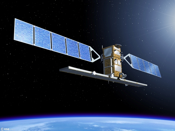
A Synthetic Aperture Radar (SAR) Satellite is able to provide all weather, day and night imaging, penetrating clouds and fog, and detecting man-made objects. An Australian SAR satellite could be tasked to image anywhere in the search and rescue area twice per day. It could cover wide areas in scan modes, providing an effective means for broad area reconnaissance and searches. Once detections are made, the search area can be concentrated, allowing planes, UAVs and ships to be deployed more efficiently to provide detailed observations and possible identification. Read more