The unwinnable contest for Himalayan water resources

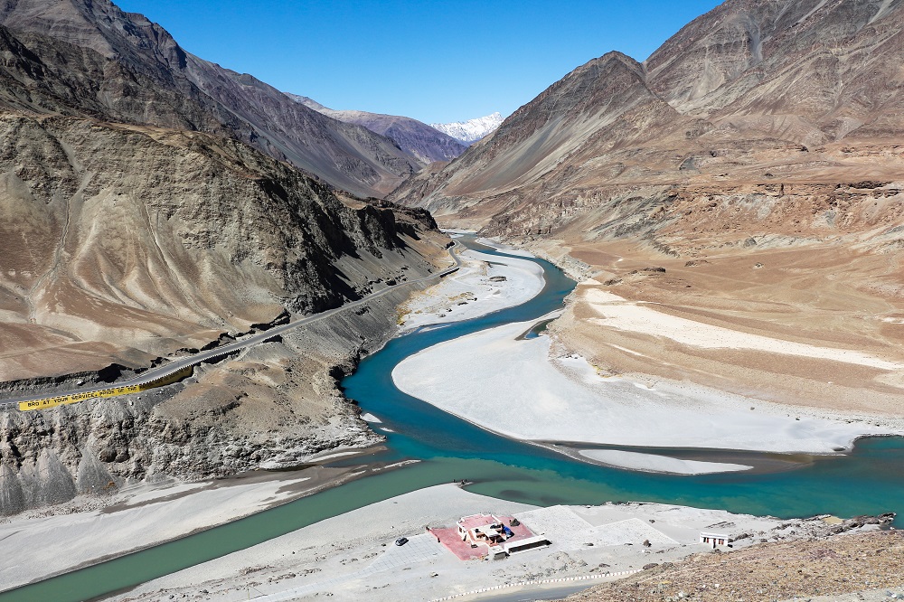
For millions of years, monsoonal winds have cycled between Asia’s tropical seas and the Tibetan Plateau, delivering snow to its high-altitude mountains and rains to the plains below them. The melting snow and summer rains combine to create a system of rivers that fan out from the mountains, delivering water and fertile soil to East, Southeast and South Asia.
Known as the Great Himalayan Watershed (GHW), this hydrological phenomenon has created richly diverse ecosystems and the right conditions for some of the world’s earliest agricultural and urban centres. The GHW encompasses most of Asia’s rivers—today around 45% of the world’s population depends on the watershed and it is home to many significant manufacturing centres and trade networks. Despite this, the GHW has received little public or political attention.
Increasing attention is now being paid to the watershed’s degraded state. Scientists, environmentalists and locals are particularly concerned about its glaciated headwaters and its deltas. Both are experiencing accelerated climate change and biodiversity loss.
The best-case scenario for the GHW would be a pervasive management plan, focused on its interconnected headwaters and threatened deltas. But the complex mix of the ‘geo’ and ‘political’ within the GHW makes a management solution unlikely.
China controls the uppermost reaches of all these rivers, but only the Yellow and Yangtze Rivers flow within its boundaries. Even then, their upper reaches lie in Tibetan ethnic regions—environments foreign to most Chinese citizens. The Mekong, Salween, Brahmaputra, Ganges and Indus Rivers are transboundary river systems and most of them transverse more than two countries.
In the GHW’s southeast, intergovernmental organisations have only made tentative steps towards the transnational management of the Mekong. On its southern side, cooperation is proving even more elusive. The Indus, Brahmaputra and many of the Ganges’ tributaries flow through areas contested by China, India, Bhutan, Nepal and Pakistan. These river systems are not only un-managed, but a heavy military presence within them is also further straining their fragile ecologies.
All Himalayan nation-states are now concerned about water security, but their competitive efforts to secure the GHW’s water are depleting rather than reviving its rivers.
Border standoffs are at least partially a result of the region’s topographical imbalance. China’s control of the rivers’ sources is a powerful strategic advantage that feeds paranoia in downstream countries. New development and technologies have allowed China to increase its presence on the plateau, and it has also demonstrated a willingness to manipulate the region’s water flows and water flow data.
After the Doklam standoff between India, Bhutan and China in 2017, China refused to adhere to its data sharing agreement with India on flow levels. India depends on this data to prepare for monsoon floods—a lack of information about river flows puts lives at risk. While the Indian government’s reaction was mute, perhaps given its ability to monitor the river through military satellites, the media stoked local fears. Many people living along India’s north-eastern rivers now fear that China will use flash floods or even river-delivered poison against them.
The rivers are being mined for gold and other metals, sand and boutique water, and are being dammed for large hydropower projects. The size of these hydropower projects reveals their builders’ state-making intent; large projects allow governments to solidify their control in ethnic minority regions, make ‘first use’ water usage claims against international competitors and connect the periphery to the centre through the electricity grid.
One country’s hydropower projects would put environmental strains on this river system. Mirrored projects on either side of international borders are a result of intensifying competition for resources between states. On the upper Indus River, for example, China, India and Pakistan have all built hydropower dams within a few hundred kilometres of each other. One well-managed hydro project could have provided enough energy for the entire region.
Like many other minoritised areas, the Himalayas’ resources are being extracted for the benefit of urban majorities. Any local resistance to the hydropower projects has been curtailed by heavy state presences across the Himalayas.
China, India and Pakistan have approached the mountains as distant, impenetrable and effectively empty. India and China took effective control of the region in the 1960s, marginalised its peoples and dissected their homelands with international borders.
Despite promoting themselves as the world’s premier post-colonial states, they have behaved like colonists in these mountains by importing lowland populations and armies and extracting their resources.
The rivers that flow from the Himalayan icepack are notorious border flouters and continuously work to erode state infrastructure. The states’ intensely nationalistic approach to these rivers is not only environmentally disastrous but also fundamentally impractical.
The environmental strains that militarisation and resource extraction place on the region will eventually force change. The degradation of the upper GHW will make it unliveable for soldiers and locals. Intensifying upstream decline will impact the billions of people who live downstream.
The GHW needs an international management council that would balance the needs of its fragile glacial heights, large downstream populations and biodiverse deltas.
It would need to combine icepack and river management. The ‘third pole’ could be managed by an organisation like the Arctic Council, which operates between the governments and indigenous peoples of the Arctic. This body could then liaise with a series of river management authorities that could be modelled on the existing Mekong River Commission.
But what would it take to create such a council? Forward thinking or a catastrophe?